Mazatlán is the only port in this series above a Level 2 advisory, and that has to be the first thing said rather than a footnote. It is also a genuinely rewarding independent port day, with a marked walking route into one of the best-preserved historic centers on Mexico's Pacific coast. Both of those are true, and neither cancels the other.
What follows is the corridor, drawn precisely: where the US State Department permits its own employees to go, where Mexico's cruise-day security deployment operates, and where the Blue Line takes you. They are very nearly the same map.
The advisory, in its own words
The US State Department rates Sinaloa Level 4, “Do Not Travel”,
citing violence linked to terrorist groups, cartels, gangs and criminal organizations. It
then carves out Mazatlán for its own personnel: US government employees may travel
there by air or sea only, are limited to the Zona Dorada and the historic
town center, and must use direct routes between those areas and
the airport and cruise terminals.
That carve-out is not a blanket exemption for every traveler, and it is
not a statement that conditions are permanently stable. It is a set of conditions under
which one employer permits movement. Read the
current advisory
and any active security alerts before your call, and treat your ship's guidance on the day
as governing.
Two things follow that are worth stating plainly. A cruise passenger arrives by sea — the permitted mode. And the two areas named in the carve-out, the Zona Dorada and the historic center, are precisely the two areas this itinerary uses. That is not a coincidence, and it is not a reassurance either. It is the shape of the corridor, and corridors have edges.
Código Azul: what Mexico deploys on a cruise day
Sinaloa's tourism secretariat runs an interinstitutional rapid-response plan activated for cruise arrivals. Roughly 700 security personnel deploy across the pier, Centro Histórico, Olas Altas, Paseo Claussen, Avenida Del Mar and the Golden Zone, coordinating municipal, state and federal police with Sedena, the port authority (Asipona) and Municipal Transit. The 2026 season anticipates around 513,000 cruise passengers across 157 calls.
Read that in both directions. There is a substantial, named, publicly documented deployment covering exactly the zones a cruise passenger uses — and it has been reinforced following security incidents in the center. A protection operation of that size is evidence of seriousness on both sides of the ledger. It is not a reason to relax, and it is not a reason to stay aboard. It is a reason to stay inside the corridor it covers.
The corridor, zone by zone
| Zone | What it is | US govt employee permitted area | Código Azul | Practical note |
|---|---|---|---|---|
| Cruise pier & terminal | Working commercial port | Inside the permitted corridor | Covered by Código Azul deployment | Shuttle between ship and terminal. Walking the port zone is not an option |
| Centro Histórico Plazuela Machado, Pino Suárez | The main draw — compact, walkable, characterful | Named in the permitted areas for US government employees | Covered | End of the Blue Line. Cobbles, curbs and heat are the real constraints |
| Olas Altas & the southern Malecón | Waterfront, public art, a shorter coastal extension | Adjacent to the historic center | Covered — Olas Altas and Paseo Claussen named | The natural second zone if you want sea air without a long ride |
| Zona Dorada (Golden Zone) | Resort corridor, beach views, modern shopping | Named in the permitted areas | Covered — Avenida Del Mar and Golden Zone named | A vehicle ride away. Check traffic before committing to it |
| Anywhere else in Sinaloa | Not a cruise-day proposition | Outside the permitted areas | Outside the named deployment | Do not improvise beyond the corridor. This is the whole point |
You cannot walk off the ship
Mazatlán's berths sit inside an active commercial port, not a pedestrianised cruise terminal. Passengers use an open-air tram or shuttle between the ship and the passenger terminal; walking the restricted port zone is not a normal visitor option, and the shuttle may be operationally required on your call.
Confirm the procedure with port staff or guest services that morning, and allow extra time if several ships are in or screening has produced a queue. The Blue Line starts at the terminal exit, not at the gangway — and the return shuttle is a second queue at the end of your day, which is why the final hour in the plan below is not negotiable.
The Blue Line
A public walking route marked by blue tiles set into the sidewalk, running about 1.2 kilometers from the passenger terminal to Centro Histórico — flat, and roughly 15 to 20 minutes depending on heat, pace and crowds. It leads toward Plazuela Machado, the Pino Suárez market area, the historic plazas, and onward to Olas Altas and the southern Malecón.
The Mazatlán Tourist Aide Volunteers post identifiable volunteers along it, handing out maps and answering questions. For a first independent walk in a port that makes people nervous, that is the single most useful thing to know — there are people on the route whose job is to help, and they are easy to spot.
Marked is not step-free. The Blue Line is commonly described as flat, and that description does real work for most walkers — but expect cobbles, curbs, uneven pavement, traffic crossings, inconsistent shade and narrow historic-center sections. Confirm the markings on arrival, too: construction, events or port changes interrupt them.
The eight-hour clock
| Window | Phase | What you are doing | The thing people get wrong |
|---|---|---|---|
| 0–1 hr | Shuttle and orientation | Ship-to-terminal shuttle, then find restrooms, shade, the exit and the return shuttle point | Note the meeting point and the all-aboard time before walking away |
| 1–3 hrs | Blue Line to Centro Histórico | 1.2 km, flat, ~15–20 minutes. Plazuela Machado and the streets around it | Look for the Tourist Aide volunteers — they carry maps and answer questions |
| 3–4 hrs | A real meal, seated | Shade, water, a chair and a restroom beat one more attraction every time | Keep valuables discreet. Carry less than you think you need |
| 4–6 hrs | One second zone | Olas Altas and the southern Malecón, or the Golden Zone, or a confirmed tour | Not all three. And not Stone Island unless the call’s timing is verified |
| 6–7 hrs | Start back | Agree the fare and destination before boarding anything. Allow for traffic and port security | Leave earlier than feels necessary — the terminal shuttle is another queue |
| 7–8 hrs | Ship buffer | Terminal, shuttle, aboard. The ship’s posted instructions override this plan | Not sightseeing time. At a working commercial port, never |
Centro Histórico
Plazuela Machado and the streets around it are the day. Cafés under the arcades, restored 19th-century facades, shade, and enough compactness that a mixed-ability group can share the same block without anyone route-marching.
The Angela Peralta Theater is an exterior stop unless you have verified access. It is a working venue, so opening status depends on rehearsals, performances and events on your date. Look inside if it is open; do not build the walk around the possibility. Continue to the Pino Suárez market only if the group still has energy — it is worth seeing and it is busy, warm and close-quartered.
One second zone, not three
- Olas Altas and the southern Malecón — waterfront, public art, a short coastal extension on foot from the center. The lowest-friction second zone.
- Zona Dorada — the resort corridor, with beach views and modern shopping. A vehicle each way, so check traffic before committing; the return is where this one bites.
- A confirmed tour — worth it when it solves a real logistics problem: mobility support, language, or efficient transport between separated sights. Not as a default.
Do not add Stone Island by default. It means another water crossing and another transport chain on a day that already opens with a mandatory shuttle. Verify the specific call's timing, boat arrangements, water conditions and return plan before it is even a candidate.
Getting around
Pulmonías — the open-air vehicles Mazatlán is known for — plus taxis and buses. App-based rides exist, but pickup points near port boundaries are often restricted or unclear, and you should not assume a rideshare can enter the terminal or collect you at the ship.
Agree the destination and the fare before boarding, and ask explicitly whether the price is per vehicle or per passenger. Unlike San Juan or Cozumel, where a posted zone tariff settles it, that answer varies here — so it is a question, not an assumption. Confirm your return pickup point at the same time, before you are somewhere you need to leave from.
The value-minded baseline is unglamorous and effective: take the shuttle, walk the Blue Line, spend the day in the historic center, and pay for one vehicle-based experience only if it meaningfully improves access, comfort or timing. No independent route guarantees savings, but this one is free.
Accessibility: two separate questions
First, the shuttle. Ask your cruise line's access team, in writing, before sailing: can it take your wheelchair, scooter, cane or walker; must the device fold or must you transfer out of it; is boarding a ramp, a lift or a step-up; and can a vehicle safely carry the device. Nothing about the route matters if this answer is no.
Second, the route. Cobbles, curbs, uneven pavement, crossings, heat and narrow sections — and then, separately, whether your chosen restaurant has an accessible entrance and restroom, and whether there is enough shade and seating along the way. A device-specific route assessment beats any general accessibility rating, and travelers with limited stamina may do better with a direct vehicle to one central stop than a walk in both directions.
For multigenerational groups: plan around the slowest walker, build in seated breaks, and do not split into unplanned transportation groups. Our accessibility requests and deadlines guide has the documentation questions to put to the line before you sail.
When the Blue Line plan is the wrong plan
A marked route is helpful. It is not route-specific planning, and there are real cases where a pre-arranged vehicle or a ship-sponsored excursion is the better answer:
- A short or late-clearing call.
- A mobility device whose shuttle fit has not been confirmed.
- Heat that meaningfully affects your stamina.
- A need for guaranteed restroom access or a structured schedule.
- Young children, older adults, or a group with genuinely different walking abilities.
- Discomfort negotiating fares or navigating Spanish-language transport.
- Any point at which current security guidance advises against independent movement.
Before you go ashore
- Check the current advisory and any active security alerts — not the version you read when you booked.
- Confirm the actual port-call and all-aboard times, and whether the terminal shuttle is running and accessible.
- Confirm the Blue Line markings and current pedestrian routing on arrival.
- Confirm vehicle fit, ramps, device storage, shade and restroom access before paying for anything.
- Agree fare, destination and payment method before boarding, and settle the return pickup point.
- Treat the Angela Peralta Theater as exterior unless access is verified.
- Stay inside the corridor. Do not improvise beyond the named zones.
- Build the ship buffer and let the ship's instructions govern.
Common questions
Sinaloa is a Level 4 "Do Not Travel" state. Should I go ashore in Mazatlán?
That is your decision to make with the current advisory in front of you, and it deserves the actual wording rather than a summary. The US State Department rates Sinaloa Level 4, Do Not Travel, citing violence linked to terrorist groups, cartels, gangs and criminal organizations. It then carves out Mazatlán for its own employees, who may travel there by air or sea only, are limited to the Zona Dorada and the historic town center, and must use direct routes between those areas and the airport and cruise terminals. That carve-out is not a blanket exemption for everyone, and it is not a statement that conditions are permanently stable. Read the current advisory before your call.
What is Código Azul?
An interinstitutional rapid-response plan run by Sinaloa’s tourism secretariat and activated for cruise arrivals in Mazatlán. Roughly 700 security personnel are deployed across the pier, Centro Histórico, Olas Altas, Paseo Claussen, Avenida Del Mar and the Golden Zone, coordinating municipal, state and federal police with Sedena, the port authority and Municipal Transit. The 2026 season anticipates about 513,000 cruise passengers across 157 calls. It has been reinforced following security incidents in the center — which is worth knowing in both directions: there is a deployment, and there is a reason for it.
What is the Blue Line and where does it go?
A marked public walking route of blue tiles set into the sidewalk, running about 1.2 kilometers from the passenger terminal to Centro Histórico — flat, and roughly 15 to 20 minutes depending on heat, pace and crowds. It leads toward Plazuela Machado, the Pino Suárez market area, the historic plazas and on to Olas Altas and the southern Malecón. Mazatlán Tourist Aide Volunteers, in identifiable shirts, are posted along it with maps. Confirm the markings on arrival — construction, events or port changes can interrupt them.
Can I walk directly off the ship into town?
No. Mazatlán’s cruise berths sit inside an active commercial port rather than a pedestrianised terminal, so passengers use an open-air tram or shuttle between the ship and the passenger terminal. Walking through the restricted port zone is not a normal visitor option, and the shuttle may be operationally required on your call. Confirm the procedure with port staff or guest services that morning, and allow extra time if several ships are in or security screening has produced a queue. The Blue Line starts at the terminal exit, not at the gangway.
How accessible is a Mazatlán port day?
Two separate questions, and they need separate answers. The shuttle is the first: ask your cruise line’s access team, before sailing, whether it can take your wheelchair, scooter, cane or walker, whether the device must fold or you must transfer, and whether boarding is a ramp, a lift or a step. The route is the second: the Blue Line is commonly described as flat and it is not step-free — expect cobbles, curbs, uneven pavement, traffic crossings, inconsistent shade and narrow historic-center sections. A device-specific assessment beats any general accessibility rating.
How do I get around beyond the historic center?
Pulmonías — the open-air local vehicles Mazatlán is known for — plus taxis and buses, with app-based rides existing but with pickup points near port boundaries often restricted or unclear. Do not assume a rideshare can enter the terminal or collect you at the ship. Whatever you use, agree the destination and the fare before boarding, and ask explicitly whether the price is per vehicle or per passenger, because that answer varies here in a way it does not at a port with a posted tariff. Confirm your return pickup point at the same time.
Should I visit the Golden Zone or stay in Centro Histórico?
Pick one as your anchor. Centro Histórico is the more characterful and the more compact, it is where the Blue Line delivers you, and it costs nothing to reach. The Golden Zone is the resort corridor — beach views, modern shopping, a different atmosphere — and it needs a vehicle each way, which means traffic risk on the return. Both sit inside the permitted corridor. What does not work is a long historic-center morning followed by a Golden Zone afternoon on a short call; that is two transfers you did not budget for.
Is the Angela Peralta Theater worth building the day around?
Treat it as an exterior stop unless you have verified current access. It is a beautifully restored 19th-century theater on Plazuela Machado and it is a working venue, which means opening status and interior access depend on rehearsals, performances and events on your specific date. The surrounding plaza is the genuine attraction for a cruise day regardless — cafés, arcades and shade in one compact block. Look inside if it is open, and do not let a closed door feel like a wasted walk.
What about Stone Island?
Do not add it by default, and this is one of the few places where a port guide should say so plainly. It involves an additional water crossing and a transport chain on a day that already begins with a mandatory shuttle, and the specific call’s timing, boat arrangements, water conditions and return plan all need verifying before it is even a candidate. On a standard eight-hour call, Centro Histórico plus one second zone is the plan that reliably works. Stone Island is what you consider on a long call with a ship-sponsored excursion holding the timing.
When should a Mazatlán day be a ship excursion instead?
When the Blue Line strategy does not fit your circumstances — and there are several genuine cases. A short or late-clearing call. A mobility device whose shuttle fit has not been confirmed. Heat that meaningfully affects stamina. A need for guaranteed restroom access or a structured schedule. Young children, older adults, or a group with different walking speeds. Discomfort negotiating fares in Spanish. And, most importantly, any point at which current security guidance advises against independent movement. A marked route is a helpful thing. It is not route-specific planning.
Sixth in our port-guide series, and the only one above a Level 2 advisory. Cabo San Lucas is usually the same Mexican Riviera itinerary and a completely different kind of day — an anchorage where the tender is the whole problem. See also Cozumel, San Juan, St. Thomas and Grand Turk.
Mexican Riviera itinerary, planned honestly?
Mazatlán, Cabo and Puerto Vallarta usually come as a set, and they need three different plans — one advisory-aware, one built around a tender, one straightforward. Send me your itinerary and I will tell you which calls deserve an excursion, which are a walk and a good hat, and where I would stay aboard.
Ask PaoloSources
- U.S. Department of State — Mexico travel advisory (Sinaloa: Level 4, and the Mazatlán restrictions for U.S. government employees)
- Gobierno del Estado de Sinaloa — “Código Azul” cruise operations plan
- Punto MX — what Código Azul means for cruise passengers in Mazatlán
- TV Pacífico — Código Azul reinforced following incidents in the center
- Mazatlán Tourist Aide Volunteers — the Blue Line
- Cruise Critic — reasons to go ashore in Mazatlán
- CruiseMapper — Mazatlán port
Images
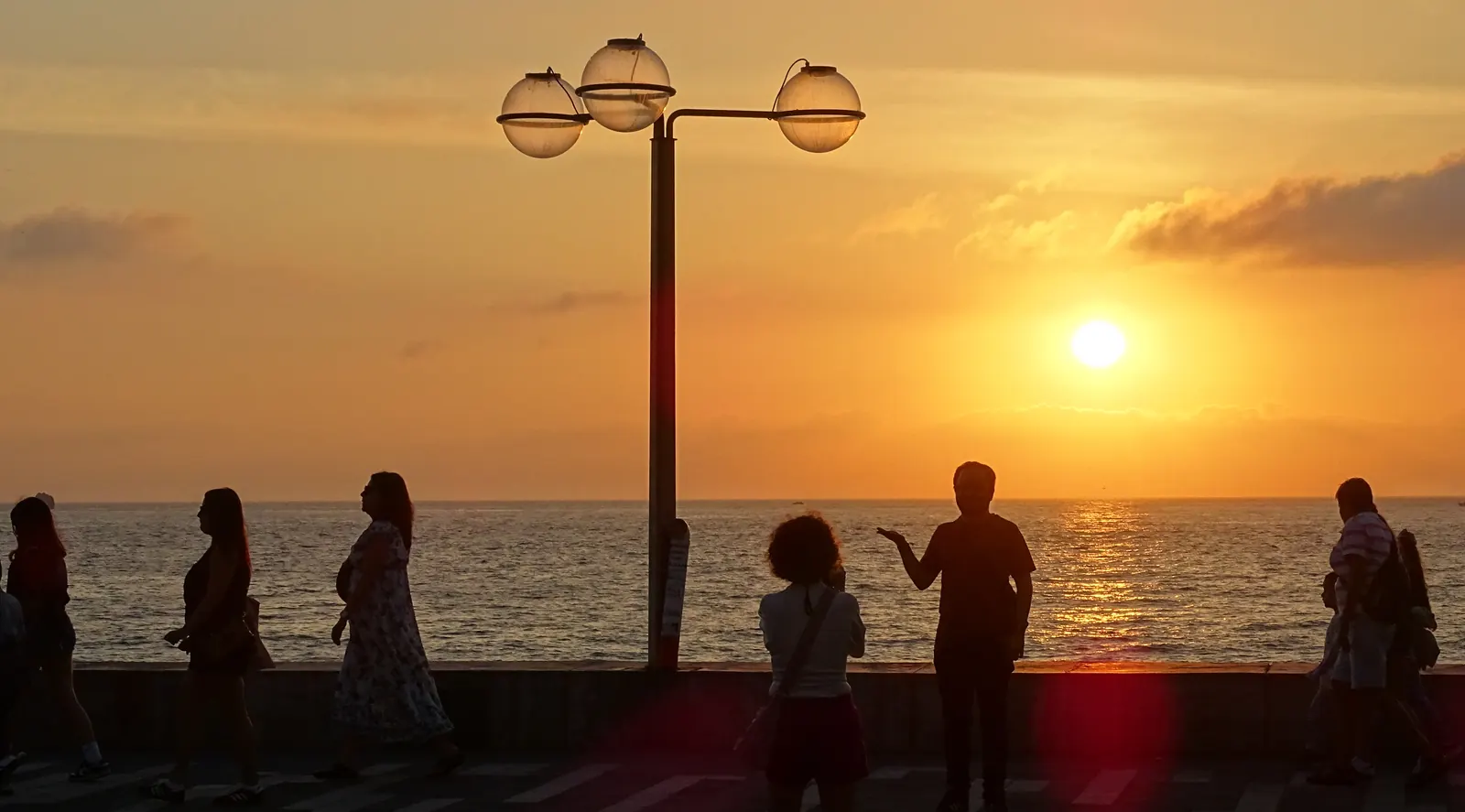
- Sunset along the Malecón, Mazatlán — Adam Jones, CC BY 4.0, via Wikimedia Commons.
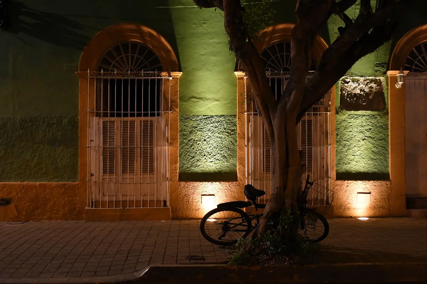
- Plazuela Machado, Centro Histórico — Gzzz, CC BY-SA 4.0, via Wikimedia Commons.
Change disclaimer. Checked August 29, 2026 against the US State Department Mexico travel advisory, Sinaloa state government Código Azul announcements, Mazatlán Tourist Aide Volunteers and current port guidance. Security guidance changes, and it can change between booking and sailing — the advisory quoted here is current as at the check date and is not a substitute for reading it yourself before your call. Port operations, shuttle procedures, pedestrian routing, fares, opening hours, accessibility arrangements, traffic and all-aboard times also change. This article is informational and is not a booking, a quote, a safety assurance, or a guarantee of availability or access. Where the State Department, local authorities, the port, an operator or your cruise line differ from anything here, theirs governs.